Hike the Island!
Angel Island State Park offers one of the best ways to see San Francisco
Angel Island offers an abundance of hiking opportunities. Whether you take a guided hike or head out on your own…
Reservations with a minimum of 25 participants are required. Please email our Event Sales Manager at abrieno@vista-rec.com for more information.
PERIMETER TRAIL
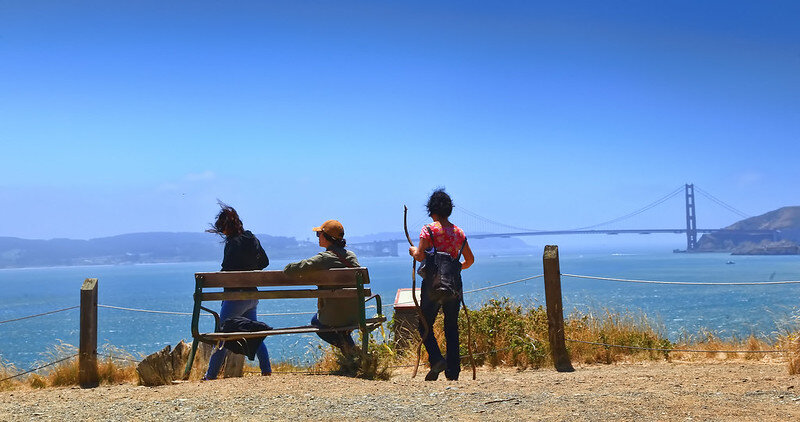
The perimeter trail offers views of the entire San Francisco Bay along the 5.5mile loop around the island. This the most popular trails on the island and is open to hikers and bikes (rentals available at the island on a first come basis). The route offers a variety of views; on a clear day from San Francisco side of the island near battery Ledyard one can see the Golden Gate bridge, Bay bridge, and Alcatraz from a single vantage point. The road around the island is paved but contains a few major hills as well as rolling hills totaling up to about 350 in total elevation gain. The two steepest hills are Climbing up from Ayala Cove as well as going up to four corners if you travel counter clockwise on the perimeter road or going up to the Nike missile base (steeper) if you travel clockwise. The directions are based on the state park map with the top of the page being north.
MT. LIVERMORE
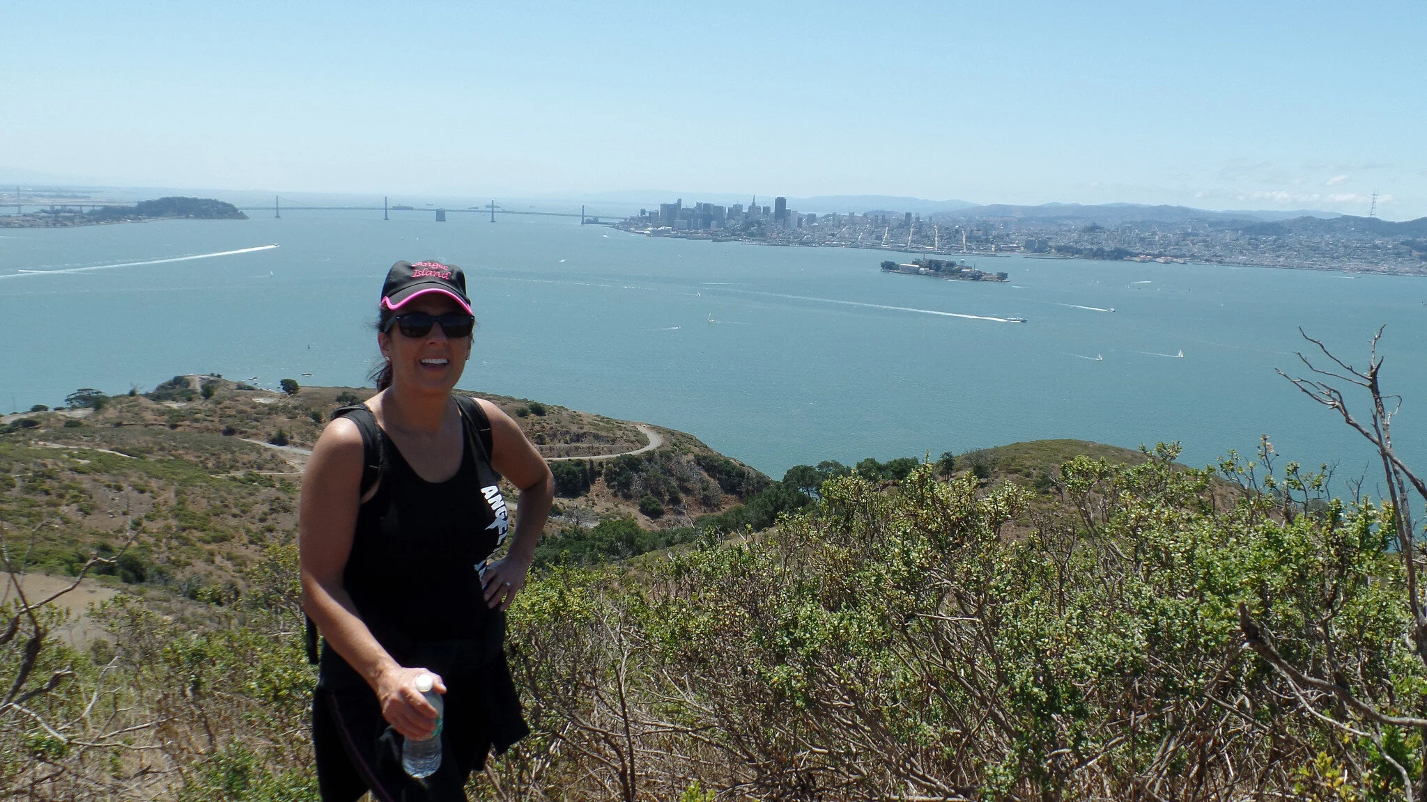
The peak of Mt. Livermore is 788 feet tall and has views that span all of the island and bay area from it’s top. The name of the peak comes from Caroline Livermore a conservationist who’s efforts in protecting the island led to Angel Island becoming a state park enjoyed by tens of thousands of visitors every year. This is a strenuous hike starting starting at sea level then climbing to the peak (788 feet). There are two routes one following the Sunset trail, from the cove to the peak it is a little over 3 miles and 800 feet of elevation gain. The other route is to follow the North ridge trail to the peak this hike is about 3.5 miles and the same elevation gain but starts with 144 steps going up to the perimeter road. Both of theses trails intersect about a third of a mile from the peak allowing hikers to choose a different route down. This is a difficult hike but rewards hikers with panorama views of the bay. While at the summit there are tables perfect for a picnic prepared to go by the Angel Island café staff.
IMMIGRATION STATION TRAIL
Work up a sweat and learn some fascinating history on a hike to the United States Immigration Station. The hike is slightly strenuous and includes 144 trail stairs beginning and ending in Ayala Cove. Once at the site of the United States Immigration Station, hikers can tour the grounds and outdoor interpretive displays, as well as visit the USIS museum to see the restored detention areas and Chinese poetry engraved on the walls. Hike participants eat lunch at the beach and then head back to the cove. Hike distance is approximately two (2) miles roundtrip.